Overview
Johannesburg is the capital of Gauteng, which is the South African province with the biggest population comprising approximately the 24 percent of the overall population. As of 2016 Johannesburg had an estimated population of 4.4 million, and according to the census, the city has grown at an extremely high rate: an average of 4.1 percent between 1996 and 2001 and by 3.2 percent between 2001 and 2011. Although this urbanisation boom is projected to slow down, Johannesburg is expected to reach 7 million inhabitants by 2040.
The city is a global financial centre and economic powerhouse. Its economy has grown faster than South Africa as a whole and, despite inward migration, has managed to increase employment rate compared to the country’s average. At the same time, Johannesburg has high levels of unemployment, poverty and one of the highest levels of inequality in the world. The city has grown in a fairy sprawled fashion over the past 20 years, although it has adopted a series of strategies and policies to become denser. However, the city's spatial structure is characterized with a series of shortcomings, including spatial inequality, fragmentation and spatial disconnection, limited land use diversity and pressure on the natural environment. The areas of highest densities of housing, the ‘townships’ inherited from Apartheid spatial policies, are also some of the most deprived areas in the city which are located far from economic opportunity. Johannesburg’s urban form has been influenced by a car-oriented planning and enforced spatial segregation, generating many negative effects on transport. This includes increased travel times and structural car-dependency, which have the highest impact on low-income communities who have to travel long distances to reach jobs and services. At the same time, mobility is one of the sectors most affected by technological advances and the new societal trends, which are sometimes referred to as the Fourth Industrial Revolution (4IR).
Highlighted Publication

Johannesburg City Context Report
Download Document
Challenges
Projects
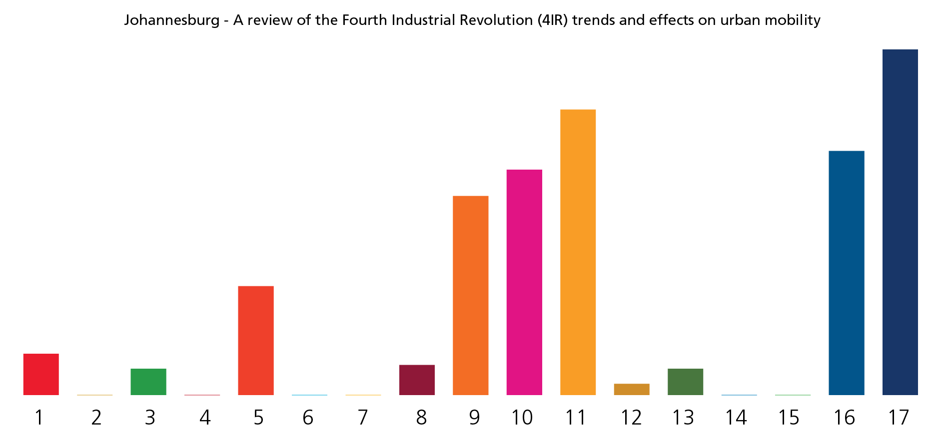
1 A review of the Fourth Industrial Revolution (4IR) trends and effects on urban mobility in Johannesburg
View DetailsMobility in Johannesburg is an area of intervention that the Municipality highlights as strategic. It is in fact seen as a potential driver for the fundamental spatial transformation that will overcome the fragmentation and social exclusion which still affect the city. Although the City of Johannesburg has developed a series of transport strategies and programmes, which seek to meet the objectives and outcomes of the city’s Joburg 2040 Growth and Development Strategy (GDS) as well as relevant statutory plans, the city faces a number of transport challenges: Congestion, crime, exclusion, lack of reliable, safe and affordable public transport.
At the same time, mobility is one of the sectors most affected by technological advances and the new societal trends, which are sometimes referred to as the Fourth Industrial Revolution (4IR). The sharing economy, Internet of Things (IoT) and artificial intelligence have radically changed the way people move in cities and are developing at an exponential rate.
The intervention proposed by the Global Future Cities Programme will assess which trends of the 4IR are impacting urban mobility in the City of Johannesburg. Key amongst this assessment will be the identification of the changes that can be considered positive and contribute to broader goals of creating a prosperous and equitable society. Based on this assessment, the city will determine the most appropriate pathways for Johannesburg and develop an implementation plan that details the policy, regulatory and fiscal interventions to be pursued.
Project Timeline
-
Charrette
September 2018 -
Validation Workshop
November 2018 -
MoU signing
-
Kick-off Meetings
September 2019 -
SDG Project Assessment Tool Tailoring Workshop
January 2020
SDG TOOL

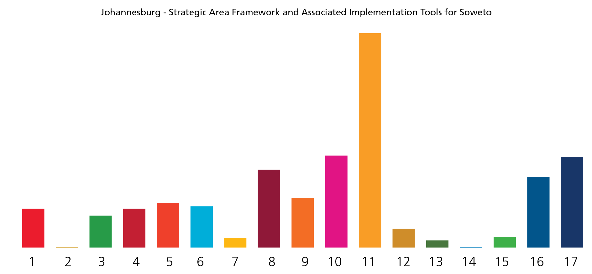
2 Strategic Area Framework and Associated Implementation Tools for Soweto “Triangle” in Johannesburg
View DetailsIn its Spatial Development Framework (SDF 2016), the City of Johannesburg identified Soweto as one of its key intervention areas. Soweto is mainly residential, lacking social services and employment opportunities. It has one of the highest population densities but the lowest concentration of formal jobs within Johannesburg. The area also faces environmental sensitivities and is prone to, amongst other issues, flooding. Nonetheless, the area has the potential of developing into a significant City district which can play a large role in contributing to economic growth.
The Intervention aims to compile a development framework for a defined part of Soweto in line with the SDF. The study area (the ‘triangle’) is bounded by Van Onsellen Road to the north; Klipspruit Valley Road to the east; Chris Hani Road to the south and Koma Road and Elias Motsoaledi to the west. The plan should integrate the socio economic, environmental, spatial and transport challenges related to Soweto. The primary objective of this study is to define clearly a sustainable spatial and economic development vision and trajectory for the broader study area.
The secondary objective is to prioritise, package and design projects and interventions that will catalyse and support the achievement of the development vision and ideal land use mix.
Project Timeline
-
Charrette
September 2018 -
Validation Workshop
November 2018 -
MoU signing
-
Kick-off Meetings
September 2019 -
SDG Project Assessment Tool Tailoring Workshop
January 2020
SDG TOOL

