Overview
Designated as a catalyst development corridor, Iskandar Malaysia is one of Malaysia’s fastest growing areas in terms of population and economic activity. By 2025, the population is expected to have doubled from 1.6 million in 2006 to 3 million, whilst the GDP is expected to grow at an annual rate of change of 6 per cent. Established in 2006, Iskandar Malaysia was largely funded by the federal government’s investment arm, Kazanah Nasional Berhad. The objectives for Iskandar Malaysia’s establishment were to strengthen Malaysia’s economic competitiveness and improve the quality of life for its citizens. Due to its strategic geographical location, as the southern gateway to Malaysia and neighbouring Singapore, Iskandar Malaysia is well positioned to increase its transboundary economic activity. By 2040, 95% of Iskandar Malaysia’s population is expected to be urbanised. However, the region’s rapid economic and population growth are compromising sustainable urban development. Heavy real estate investments beyond the current housing demand is causing drastic levels of urban sprawl. The population density is expected to drop from 20 to 12 persons per hectare. These unsustainable urban development patterns are putting immense pressure on Iskandar Malaysia’s physical infrastructure. To support the sustainable growth of Iskandar Malaysia, two projects have been identified: (i) an Implementation Strategy for Iskandar Malaysia’s Smart Integrated Mobility Management System, and (ii) Enabling Data Utilisation and Data Management for Evidence-Based Urban and Transport Planning.
Highlighted Publication

Iskandar City Context Report
Download Document
Challenges
Projects
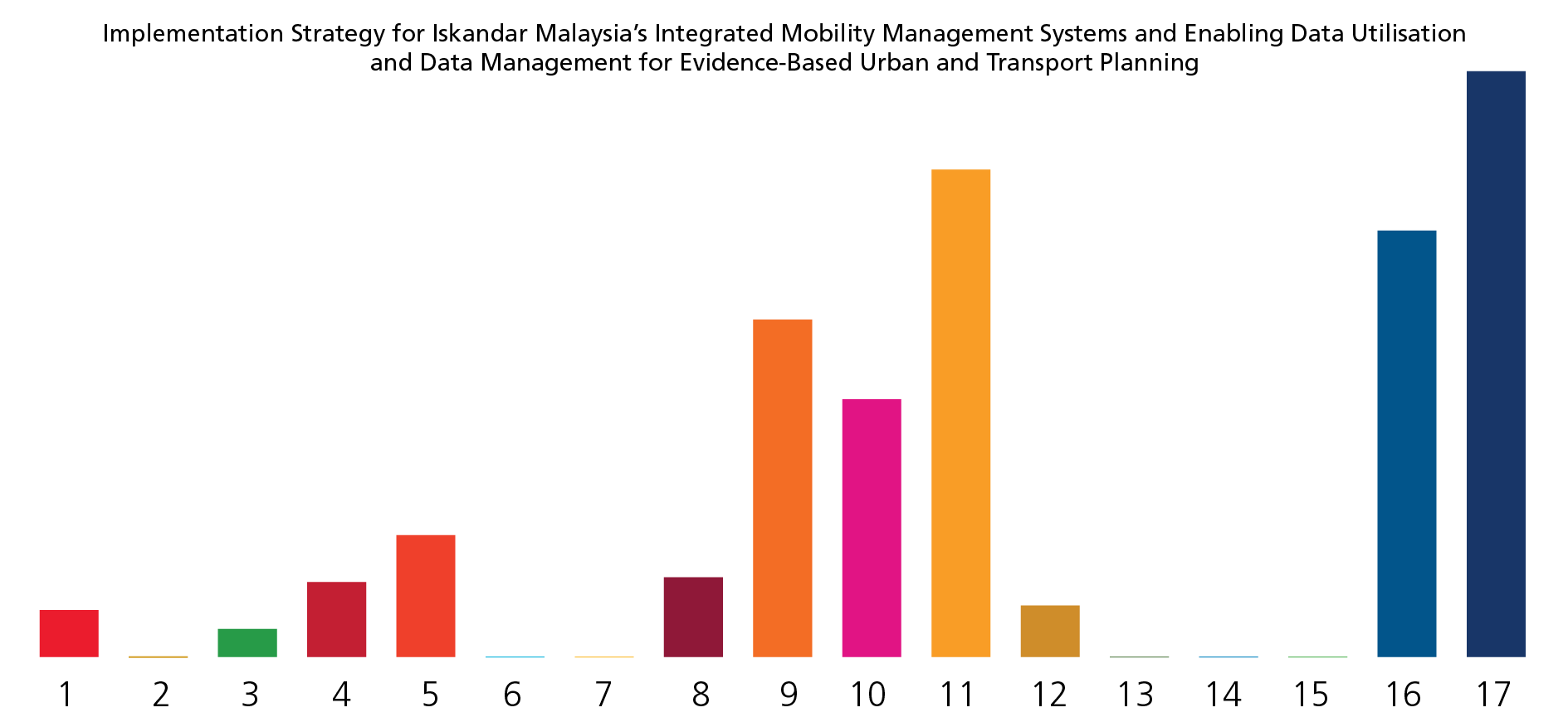
1 Implementation Strategy for Iskandar Malaysia’s Smart Integrated Mobility Management System (SIMMS) and Enabling Data Utilisation; and Data Management for Evidence-Based Urban and Transport Planning
View DetailsIskandar Malaysia’s mobility system both crossing into Singapore and throughout the rest of the region, is experiencing substantial levels of congestion. The current inefficiencies of the mobility system are a cause of concern, economically, environmentally and socially. High reliance on private motorised transport infringes on productivity due to time and money lost travelling and moving goods. Greenhouse gas emissions, particulate matter, air, and noise pollution are creating a stressful and unhealthy urban environment. Although Iskandar Malaysia is heavily investing in public transport, for example through the introduction of a Bus Rapid Transit (BRT) system and the development of a mobility planner application, the need remains to optimise the road network. To prevent the continuation of road expansions, traffic needs to be managed and planned more effectively. In response to these needs, a Smart Integrated Mobility Management System (SIMMS) will be developed. The proposed SIMMS will be designed to serve as a key foundation for a sustainable mobility system in Iskandar Malaysia by supporting day-to-day traffic operations as well as long-term transport planning.
To ensure the effective utilisation of the data collected by SIMMS, as well as other sources, the second component of the project is focused on Creating Enabling Conditions for Data Utilisation and Management for Evidence-based Urban and Transport Planning. Operational management and long-term planning require a reliable database that enables planners to find evidence-based solutions to the urbanisation challenges of the region. This project component will improve capacity in Iskandar Malaysia to use smart technologies and data analysis to inform future spatial and transportation plans. It connects directly with the Iskandar Malaysia Urban Observatory (IMUO) by creating a framework and building the necessary capacity to enable the integrated use of data across sectors and authorities. Through an integrated approach of informing both urban and transport planning, the project aims to be able to tackle issues such as the lack of accessibility and connectivity in the region, which threatens to heighten social exclusion particularly for those who cannot or do not drive.
Project Timeline
-
Charrette
August 2018 -
Validation Workshop
December 2018 -
MoU signing
July 2019 -
Kick-off Meetings
November 2019 -
Kick-off Meetings
November 2019 -
SDG Project Assessment Tool Tailoring Workshop
January 2020
SDG TOOL

